


Comanche County (Central)--Lawton City PUMA, Oklahoma
About
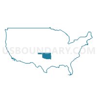
Outline
--Lawton+City+PUMA%2c+Oklahoma_A280.png)
Summary
| Unique Area Identifier | 193785 |
| Name | Comanche County (Central)--Lawton City PUMA |
| State | Oklahoma |
| Area (square miles) | 537.47 |
| Land Area (square miles) | 536.01 |
| Water Area (square miles) | 1.46 |
| % of Land Area | 99.73 |
| % of Water Area | 0.27 |
| Latitude of the Internal Point | 34.58520280 |
| Longtitude of the Internal Point | -98.42861360 |
Maps
--Lawton+City+PUMA in Oklahoma.png)
Graphs
Select a template below for downloading or customizing gragh for Comanche County (Central)--Lawton City PUMA, Oklahoma
--Lawton+City+PUMA%2c+Oklahoma_T0.png)
--Lawton+City+PUMA%2c+Oklahoma_T1.png)
--Lawton+City+PUMA%2c+Oklahoma_T2.png)
--Lawton+City+PUMA%2c+Oklahoma_T3.png)
--Lawton+City+PUMA%2c+Oklahoma_T4.png)
--Lawton+City+PUMA%2c+Oklahoma_T5.png)
--Lawton+City+PUMA%2c+Oklahoma_T6.png)
--Lawton+City+PUMA%2c+Oklahoma_T7.png)
--Lawton+City+PUMA%2c+Oklahoma.png)
Neighbors
Neighoring Public Use Microdata Area (by Name) Neighboring Public Use Microdata Area on the Map
Top 10 Neighboring County (by Population) Neighboring County on the Map
- Comanche County, OK (124,098)
- Stephens County, OK (45,048)
- Tillman County, OK (7,992)
- Cotton County, OK (6,193)
Top 10 Neighboring County Subdivision (by Population) Neighboring County Subdivision on the Map
- Lawton CCD, Comanche County, OK (72,351)
- Duncan CCD, Stephens County, OK (28,807)
- Southeast Comanche CCD, Comanche County, OK (16,988)
- Fort Sill CCD, Comanche County, OK (10,996)
- Southwest Comanche CCD, Comanche County, OK (10,857)
- Marlow CCD, Stephens County, OK (8,477)
- Northeast Comanche CCD, Comanche County, OK (6,966)
- Northwest Comanche CCD, Comanche County, OK (5,940)
- Walters CCD, Cotton County, OK (3,794)
- East Tillman CCD, Tillman County, OK (1,488)
Top 10 Neighboring Place (by Population) Neighboring Place on the Map
- Lawton city, OK (96,867)
- Cache city, OK (2,796)
- Elgin city, OK (2,156)
- Geronimo town, OK (1,268)
- Central High town, OK (1,199)
- Empire City town, OK (955)
- Chattanooga town, OK (461)
- Medicine Park town, OK (382)
- Faxon town, OK (136)
Top 10 Neighboring Elementary School District (by Population) Neighboring Elementary School District on the Map
Top 10 Neighboring Unified School District (by Population) Neighboring Unified School District on the Map
- Lawton Public Schools, OK (92,621)
- Cache Public Schools, OK (7,884)
- Elgin Public Schools, OK (7,654)
- Geronimo Public Schools, OK (4,497)
- Walters Public Schools, OK (3,537)
- Sterling Public Schools, OK (2,235)
- Empire Public Schools, OK (2,184)
- Central High Public Schools, OK (2,048)
- Indiahoma Public Schools, OK (1,430)
- Chattanooga Public Schools, OK (1,330)
Top 10 Neighboring State Legislative District Lower Chamber (by Population) Neighboring State Legislative District Lower Chamber on the Map
- State House District 64, OK (37,821)
- State House District 51, OK (37,430)
- State House District 63, OK (36,149)
- State House District 62, OK (35,913)
- State House District 50, OK (35,868)
- State House District 65, OK (35,531)
Top 10 Neighboring State Legislative District Upper Chamber (by Population) Neighboring State Legislative District Upper Chamber on the Map
- State Senate District 24, OK (98,936)
- State Senate District 31, OK (78,520)
- State Senate District 32, OK (73,590)
- State Senate District 26, OK (69,504)
Top 10 Neighboring 111th Congressional District (by Population) Neighboring 111th Congressional District on the Map
Top 10 Neighboring Census Tract (by Population) Neighboring Census Tract on the Map
- Census Tract 5.01, Comanche County, OK (7,888)
- Census Tract 21, Comanche County, OK (6,966)
- Census Tract 5.02, Comanche County, OK (6,958)
- Census Tract 24.04, Comanche County, OK (6,551)
- Census Tract 4.01, Comanche County, OK (6,450)
- Census Tract 22, Comanche County, OK (5,940)
- Census Tract 23.01, Comanche County, OK (5,919)
- Census Tract 3, Comanche County, OK (5,830)
- Census Tract 20.05, Comanche County, OK (5,774)
- Census Tract 8, Stephens County, OK (5,241)
Top 10 Neighboring 5-Digit ZIP Code Tabulation Area (by Population) Neighboring 5-Digit ZIP Code Tabulation Area on the Map
- 73505, OK (49,809)
- 73533, OK (28,434)
- 73507, OK (22,847)
- 73501, OK (20,935)
- 73503, OK (10,996)
- 73055, OK (9,942)
- 73527, OK (5,184)
- 73538, OK (4,675)
- 73572, OK (3,699)
- 73543, OK (1,859)